Today Cloudy 23° 19°Next days
At a glance
Member benefit
Whole tour as GPX and PDF — a CARECOM.united member benefit. Membership is free and non-binding. About membership →
- Caldera Blanca loop
- Playa La Cera — views of Playa de Papagayo
- Arrecife loop
- Los Charcones — along the Costa del Rubicón
- Timanfaya — the El Golfo coast
- An improvised loop from Tinajo
- El Cuervo volcano loop
- From Charco Verde to Piedra Marcial
- A short loop from Tenésar
- Around the Janubio lagoon
- From Femés through the Los Ajaches park
- Caldera de la Rilla loop
- Playa del Embarcadero via the Camino de los Gracioseros
- The southern route — La Graciosa
- Famara cliffs
- San Juan beach — views of Famara
Two weeks on Lanzarote — on foot across the island of fire
Lanzarote in January and February: mild winter weather, almost no rain, and a landscape that looks like another planet. For two weeks we explored the island on foot — from the lava fields of Timanfaya and the rugged Famara cliffs across to the car-free neighbouring island of La Graciosa.
This report gathers the walks of the trip: from an easy coastal stroll to pathless, sure-footed volcanic terrain (T2), including the almost 23 kilometres from Charco Verde to Piedra Marcial. Where it gets tricky — closed sections, rough access roads, route-finding in open country — it is noted with the individual tour. Between the walks we visited César Manrique's art sites — the Casa-Museo, the Mirador del Río viewpoint and the Monumento al Campesino — and stopped at the surf bay of La Santa; here, though, the focus is on the paths. In total it added up to around 150 kilometres and 2,700 metres of climbing, spread across the whole island.
The walks
Caldera Blanca loop
Caldera Blanca is one of the island's largest and most symmetrical craters. The route first crosses wide lava fields and then follows the crater rim for a good stretch, with views all the way to the sea.
Playa La Cera — views of Playa de Papagayo
A relaxed coastal loop in the south, with constant views of the turquoise coves of the Papagayo beaches.
Arrecife loop
A wander through the island capital — along the Charco de San Ginés lagoon with its fishing boats and past candelabra cardón on black sand.
Los Charcones — along the Costa del Rubicón
A short evening loop along the flat lava coast of the Costa del Rubicón — just right for the sunset.
Timanfaya — the El Golfo coast
From the well-known Lago Verde at El Golfo, the route follows the coast through the frozen lava flows of the Timanfaya area.
An improvised loop from Tinajo
Because of closures and reroutes this loop turned out differently than planned — but no less beautiful. A couple of short sections are mildly adventurous; sturdy footwear is recommended.
El Cuervo volcano loop
A short, rewarding loop around the El Cuervo volcano — and a little way into its breached crater.
From Charco Verde to Piedra Marcial
At almost 23 kilometres the longest tour of the trip. It calls for sturdy footwear and sure-footing — towards the end largely T2 and barely waymarked. A demanding walk that shouldn't be underestimated.
A short loop from Tenésar
A short loop on the west coast. Along the way the komoot app crashed — which explains the slightly wayward track on the return, where we drifted a little towards the coast.
Around the Janubio lagoon
As a pure walk it's middling, and not entirely harmless given the high proportion of road; parts are closed, so it's best walked in one direction only. But the views of the salt pans and the lagoon are worth the constraints.
From Femés through the Los Ajaches park
The trip's biggest climb: up from Femés into the Los Ajaches park, over green heights with wide views down to the sea.
Caldera de la Rilla loop
A quiet loop across lava fields to the wide, extinct crater of the Caldera de la Rilla.
Playa del Embarcadero via the Camino de los Gracioseros
On the old Camino de los Gracioseros the path drops down the Risco de Famara to the coast opposite La Graciosa — a good 340 metres of descent that, of course, want climbing back up.
The southern route — La Graciosa
By ferry across to the car-free neighbouring island of La Graciosa. A full circuit in the south wasn't possible of late — one section is closed for restoration.
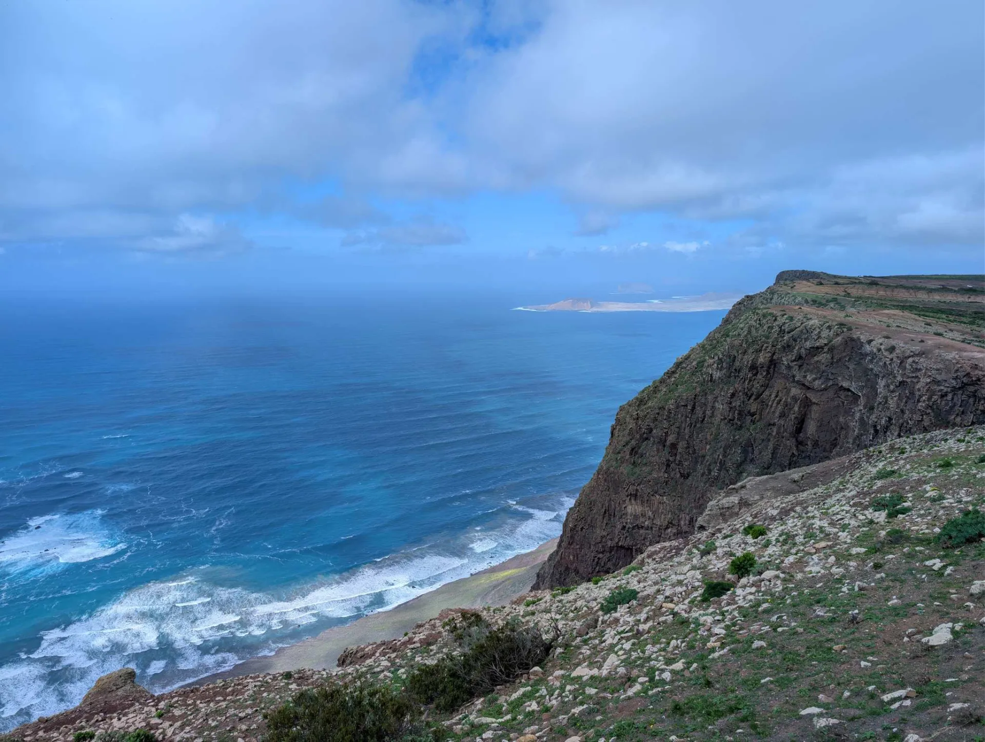
Famara cliffs
A short walk to the spectacular edge of the Risco de Famara. Note: the access road is in very poor condition for the last stretch — not for low-slung cars or weak nerves.
San Juan beach — views of Famara
The last walk of the trip, with wide views of Famara and its long beach.